Directions | How to get there
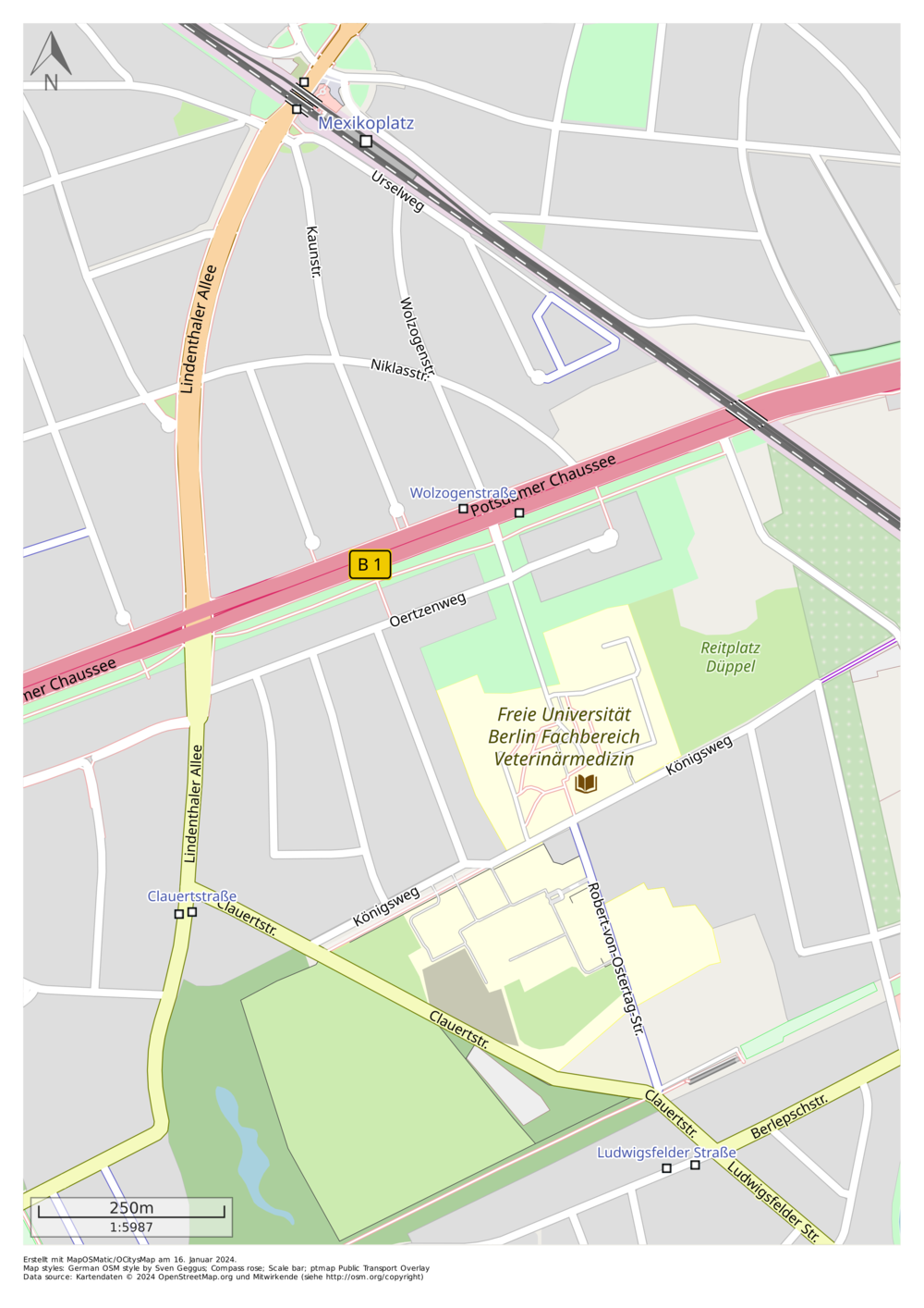
Umgebungskarte Campus Düppel (reduzierte Informationen)
Image Credit: Erstellt mit MapOSMatic / OCitys Map am 16. Januar 2024.
Kartendaten © 2024 OpenStreetMap.org und Mitwirkende (siehe https://osm.org/copyright)
Als PDF herunterladen (1,0 MB).
By car
- From Potsdamer Chaussee, turn into Oertzenweg.
- Drive onto the clinic grounds and follow the road past the small animal and pet clinic and the equine clinic on your left.
- You will reach the parking lot in front of the Veterinary Library.
By public transportation
By bus line 112
- Get off at the Wolzogenstraße stop.
- Walk up Oertzenweg in the direction of the veterinary clinics.
- Take the S-Bahn S1 to the Mexikoplatz stop or
take the U-Bahn U3 to the Krumme Lanke stop. - Take bus 118 (direction: Potsdam, Stern-Center) or 622 (direction: Stahnsdorf, Hildegardstr.).
- Get off at the Clauertstraße stop.
- Walk along Clauertstraße and turn left into Königsweg.
- The southern part of the Düppel campus is on your right.
- After approx. 300 meters you will reach the northern part of Campus Düppel, which is on your left.
By bus line 115
- Get off at the Ludwigsfelder Straße stop.
- Walk into Clauertstraße.
- At the fork in the road, turn right into Robert-von-Ostertag Straße.
- You are now on the southern part of the Düppel campus.
- Walk to the end of the street and cross Königsweg to reach the northern part of the campus.
